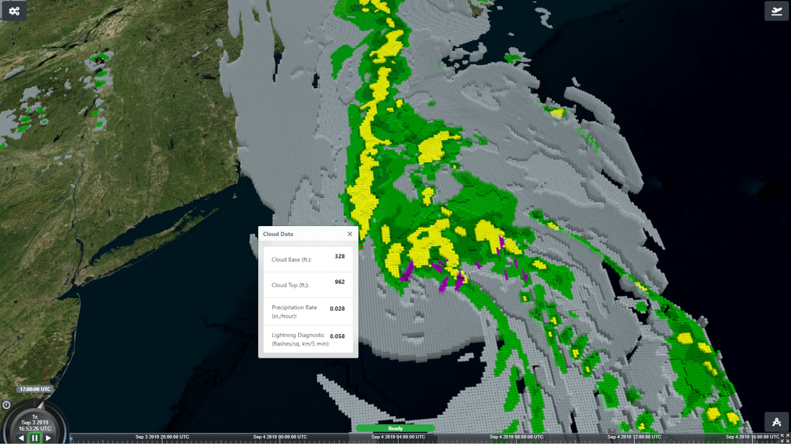
The Envision Center at Purdue University is working with Flight Profiler LLC on a program that utilizes NOAA data to display volumetric weather in 3D. The benefit of this is that general aviation (GA) pilots will be able to use this lightweight platform to assess risk during preflight planning and gain awareness of potential weather hazards that could happen during flight. Since pilots cannot fly into the clouds unless they have a special rating, they must abide by the visual flight rules (VFR) set forth by the FAA. The basics of VFR state that a pilot who is not instrument rated cannot fly into/near clouds and must maintain a certain visibility with the ground. With our technology, 3D weather visualization can help pilots determine at what point they may enter the clouds and/or areas of reduced visibility and make plans to avoid it.
Using weather data served by the National Weather Service and the National Oceanic and Atmospheric Administration, our platform is able to visualize cloud positions over the continental United States. By leveraging geospatial data streaming technology on the Cesium engine, we are able to efficiently process, download and visualize up to 2 million data points in real time on devices such as iPads and low end laptops. Along with cloud positions, other weather elements can be embedded and visualized, such as precipitation, icing and lightning.
Not only is the current weather of concern to pilots but also forecasted conditions that they may run into enroute. Our platform takes the airspeed input from the user and projects it onto a timeline to make sure that the weather is accurate during the flight. The platform leverages CesiumJS and Purdue infrastructure to stream preprocessed cloud data. The backend downloads forecasted weather data and converts it into geometry. The generation parameters on the backend allow for the generation of optimized geometry suited for specific front end platforms, such as laptops with integrated graphics or mobile devices with poor network connection.
Demo
